My Favorite Bit, Pt. I: Tasmanian Flashbacks
I think I’ve found my favorite leg of the TA: the ride to Ikamatua. I can’t speak for what’s coming down the road, of course, but I’ve only got five hundred kilometers to go (only!) so if the TA is going to top Ikamatua, it’ll have to pull out all the stops.
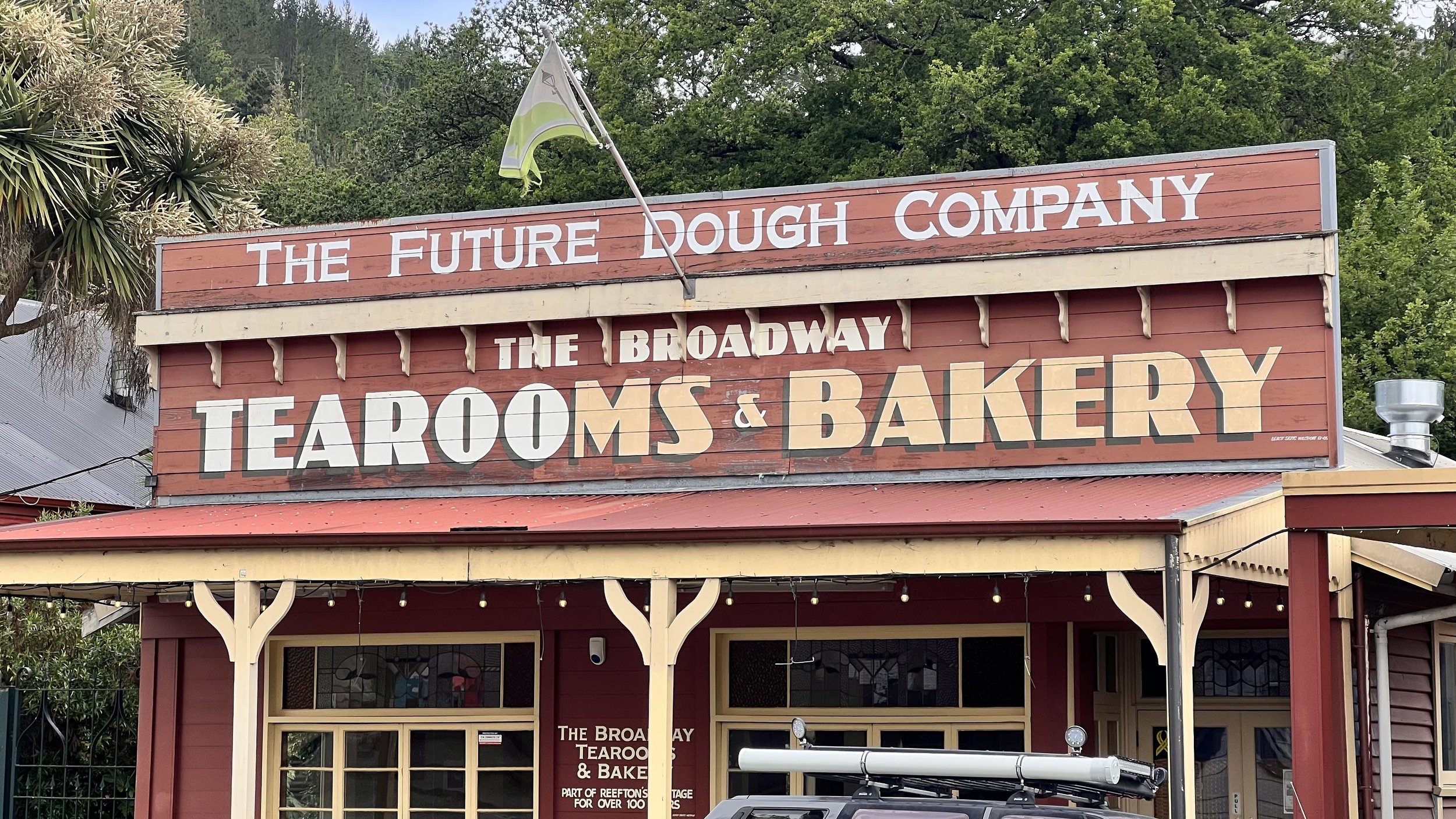
Because I’m the Worst Bikepacker in New Zealand, this is a two-parter. Part one starts in Reefton, a quaint, funky little town that played an important role in New Zealand’s nineteenth century gold rush. It’s half Deadwood, half Yellow Springs. Great food, too. For my money the Broadway Bakery is second only to the Wakey Bakey in Wakefield.

One of the great things about little towns like this is the weird places you can stay. I chose The Nurses’ Home, a seventy-year-old dormitory built for all the nurses of Reefton’s (then newly founded) medical center. A charming building, loads of character, but the best feature for me was the really hot bath. Nothing better for the post-ride legs.

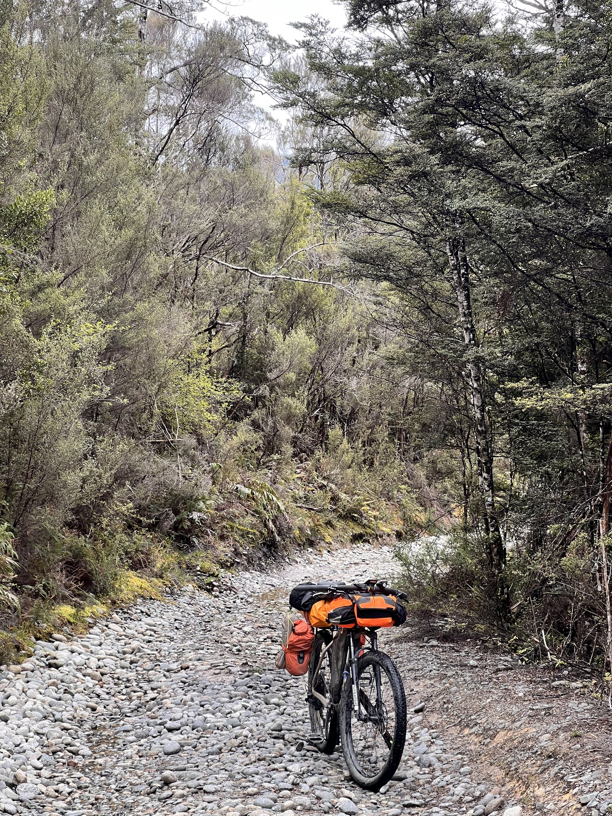
I set out from Reefton early because I knew it would be a big climbing day. Yet another gray, rainy day on the South Island, but it makes for cooler riding with less risk of sunburn, so I’ll take it. Farm roads gave way to gravel, then 4WD trail as the ride ascended into gold mining country. You’re warned not to drink the water here or even touch the soil. That’s how nasty the environmental footprint of mining can be.

But this is mountain biking, so it’s not always up to me whether I touch the soil. Sometimes the soil reaches up to touch me. My first hard fall was a river crossing, when Booster’s front tire found a pit and slammed sideways into the rock shelf on the far side. I did a fair impression of Javy Báez stealing home, but somehow came away with only a few cuts and no serious injuries. And hey, the soil didn’t melt my skin.

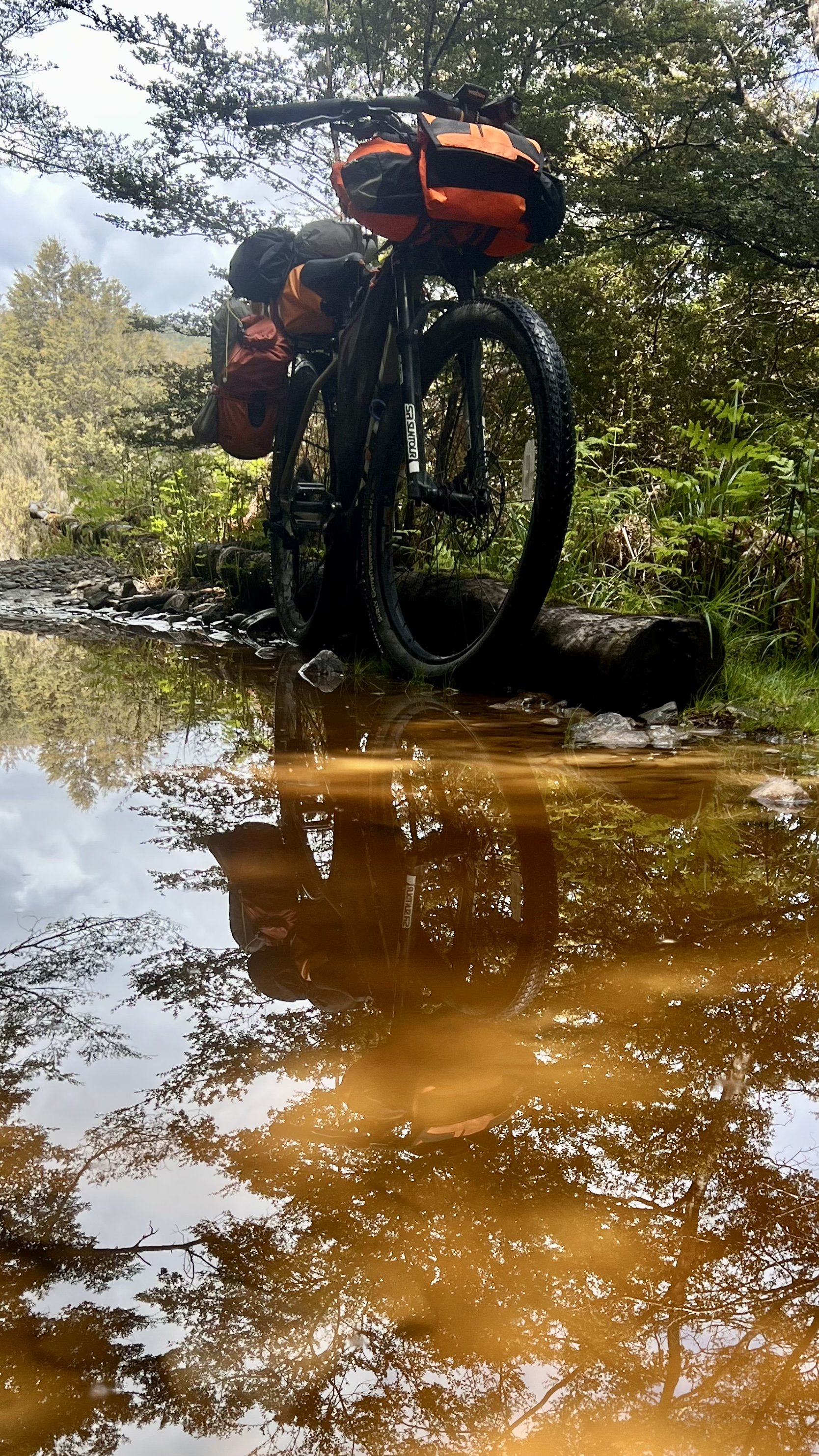
But as I climbed on, the mountain reminded me more and more of the Wellington Range on Tassie—specifically, the notorious Jeffries Track where I had my fateful night that ended with police helicopters. The terrain was steep and sharp like the TT, the rock as loose and given to slipping, the drizzle as persistent, and the trail as flooded in so many places. Even the water was the same color I saw on the Jeffries Track, like Thai iced tea.

In some places the water was over a meter deep. I went into my hips; Booster went into her handlebars. She’d have gone deeper if I’d let go; I had visions of Luke Skywalker’s X-Wing sinking into the swamp. To complete that dismal picture, my GPS compooter was beeping and whistling at me like a peevish R2 unit.
But my droid’s brain is scrambled. Yet another flashback to Tassie: navigational errors. I would later learn my mistake, one I humbly suggest would not have happened if my guidebook were to swap the order of two sentences. After the giant gold fields sign, it says to ignore all the offshoots and just skip to the main track. It needs to say that after you take one very important offshoot. Otherwise you follow—or at least Booster and I followed—the main track as it goes up the wrong mountain.

What followed was the steepest climbing I’ve seen yet. Even Tasmania never forced me to strip all the bags off of Booster, push her up the hill, then double back for the baggage. Triple the walking distance with half the weight. In hindsight, maybe I should have guessed that this was too hard a climb for the TA. The Kennett brothers, bless their hearts, would never sign me up for this misery when they put the tour together. Right?
Wrong. They sent me down the Kaiwhakauka-Mangapurura Track. They sent me over the Maungatapu Saddle. I can’t imagine anyone being able to pedal up the trail I followed from Reefton, but in all outdoor endeavors it behooves one to keep an important principle in mind: none of this was designed for you. You’re the one who came out here to give it a go. Success—or even fair odds of success—was never guaranteed.

Well, no one can say I didn’t give it a go. I followed that unbikeable track all the way to the top. That’s where I ran into a T intersection that’s not in the guidebook. That was my first indicator that I had done something wrong. The problem wasn’t only the one sentence I misinterpreted, but also that my compooter affirmed the guidebook’s ambiguous instruction. As I’ve mentioned before, my pooter is wrong more often than it’s right. What makes this one better than the last one is that its mistakes are predictable. I learned this right from the first day, on Ninety Mile Beach: it kept telling me I was going the wrong way, then self-correcting. That has been its pattern ever since.
Which is fine, considering I’m asking it to do something it’s not programmed to do. Any route over 200 kilometer is beyond its ability. I keep it around because in seven weeks of riding, there have been two or three times when it did alert me to a wrong turn. The day it does that, it justifies its continued existence. It did that on the Ikamatua ride too, but then incorrectly self-corrected. That’s why I didn’t catch the error.

Cut to the next Tassie flashback: the personal locator beacon. I didn’t hit the SOS button this time. I just remembered the beacon knows my exact latitude and longitude. Like, to five decimal points. And because navigation was such a struggle on the TT, I downloaded two nifty apps: incredibly fine-grained topographical maps, one of the North Island, one of the South. They’re accurate to five decimal points. So between the PLB and the map, I could work out exactly where I was and how to get back down to where I needed to be.
Not bad for a technophobe with no direction sense, eh? I was pretty proud of myself. But pride goeth before the fall. A precise map is an invaluable tool, but even the best maps only approximate the world. Roads change. Backwoods 4WD trails change faster. I followed my most promising path as far as it would go, and when it tapered to a dead end, my only recourse was to go all the way back down where I came from.

Which brings me to my final Tasmanian flashback: water, water everywhere and not a drop to drink. I had planned to refill at Big River Hut, which my guidebook says is the lone source of uncontaminated water on that mountain. After my detour, I got back to the (correct) path to Big River Hut with one empty bottle and 200 mL left in the other. If the (correct) trail was anything like the first one, that just ain’t enough water.
From here it’s a fast twelve-kilometer downhill cruise back to Reefton. More like six to the nearest farmhouse, where I’m sure I can refill. That would have me start my ride to Ikamatua at about 4:00 PM, after 30 kilometers of the steepest riding and hike-a-biking I’ve done yet. Or I can retreat to that nice hot bathtub.

I chose neither, but this post is already overlong, so I’ll tell you about what happened next in the next post. There’s a world record runner involved, and Dr. Kate, plus an elf-witch of terrible power.